
A Global Water Story
Water is crucial for life on Earth, and its distribution across the surface determines where people can live. The availability of water is an active concern of many citizens in the western United States, who have seen firsthand the impacts of drought in recent years. Mountain snowpack, which supplies much of the water in Colorado and states reliant on Colorado River water, is expected to decrease as the climate warms. In the past, we have built large infrastructure projects to move water to supply our cities and farms. Today we need to look to innovative technologies to help address the water challenges of the present and future.
This premier of the Worldviews Network was designed to plunge audiences into a national conversation about local and global water issues using the immersive technology of Denver’s Gates Planetarium. Typically the Planetarium is used to study space, but its capabilities were used to catalyze a discussion about interconnected Earth systems and environmental science.
This event originally took place at the Denver Museum of Nature & Science’s Gates Planetarium (Denver, CO) on May 24, 2011. It was simulcast live to The Journey Museum in Rapid City, South Dakota; RENCI/NEMAC in Asheville, North Carolina; California Academy of Sciences in San Francisco; and Como Elementary School in St. Paul as a nationwide conversation about water with scientists and other experts. In the Gates Planetarium, geologist Bob Raynolds, PhD, and space scientist Ka Chun Yu, PhD, explained the planetary processes that affect water supplies around the world and in the American West.
Google Earth Tour
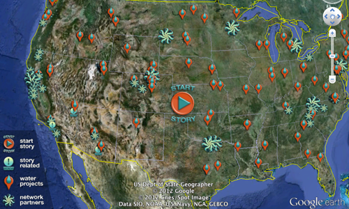
Explore A Global Water Story on your own in this interactive Google Earth tour. Learn about innovative strategies people are doing to conserve precious freshwater resources and how you can make a difference.
» Download the KMZ file (opens in a new tab) (18MB, playable in Google Earth)
If you do not have Google Earth, download the free software (opens in a new tab).
Program kit
Script and storyboard, installer, and the data sources used.
Script & Storyboard
- Read the storyboard (web page)
- Open the script and storyboard (opens in a new tab) (Google Doc)
Installer Download
Uniview Installer Files
- wvn01_water_FINAL.msi (81MB)
- Windows installer. Requires Uniview 1.5 (opens in a new tab)
Training Video
Data Sources
- Digital Universe Atlas (opens in a new tab)
- Blue Marble Next Generation
http://neo.sci.gsfc.nasa.gov/view.php?datasetId=BlueMarbleNG-TB (opens in a new tab)
http://neo.sci.gsfc.nasa.gov/view.php?datasetId=GEBCO_BATHY (opens in a new tab)
Also drawn from: National Geographic Society; Office of the State Engineer, Colorado Division of Water Resources; USDA Natural Resources Conservation Service.
Videos and visualizations related to the program.
Where do we get our fresh water?
Fresh water accounts for only 2.5% of Earth’s water, yet it is vital for human civilization. What are our sources of fresh water? In the first of a two part series on fresh water, Christiana Z. Peppard breaks the numbers down and discusses who is using it and to what ends.
WWF: Virtual Water: Change the Way You Think About Everything
How much water does it take to make one latte? We can do more using less of our natural resources, right now.
Good: Water
For World Water Day 2008, we look at the planet’s water, how it’s being used, and the increasing strains on this vital resource. Drink up!
WWF: The Importance of Water
Of all the water on this blue planet of ours, only 3% of it is freshwater. And this precious, life-giving resource has seen a decline of 35% in the species that live within its realm since 1970. We must use water more wisely. We must make better use of the bounties and services that it provides.
NASA / USGS | LANDSAT: A Space Age Water Guide
Water specialists Rick Allen, Bill Kramber and Tony Morse have created an innovative satellite-based method that maps agricultural water consumption. The team uses Landsat thermal band data to measure the amount of water evaporating from the soil and transpiring from plants leaves. Evapotranspiring water absorbs energy, so farm fields consuming more water appear cooler in the thermal band. The Landsat observations provide an objective way for water managers to assess on a field-by-field basis how much water agricultural growers are using. Landsat is a joint program of NASA and the US Geological Survey.
Good: Drinking Water
Celebrate World Water Day!
Good Transparency: Water Conservation
Thirsty? So is everyone else. We’re headed for a water shortage. Here’s how simple daily choices can reduce your water use. A GOOD Transparency video.
Reading and reference links for going further.
Water
- Best Reading for Understanding Peak Water (opens in a new tab)
- Virtual Water (opens in a new tab)
- The Virtual Water Project (opens in a new tab)
- Water Footprint Network (opens in a new tab)
- Colorado Foundation for Water Education (opens in a new tab)
- Citizen’s Guides
Citizen’s Guide to Colorado Climate Change (opens in a new tab)
Citizen’s Guide to Colorado’s Water Heritage (opens in a new tab)
Citizen’s Guide to Colorado Water Conservation (opens in a new tab)
Citizen’s Guide to Colorado Water Quality Protection (opens in a new tab)
Citizen’s Guide to Denver Basin Groundwater (opens in a new tab)
Citizen’s Guide to Colorado’s Environmental Era (opens in a new tab)
Citizen’s Guide to Colorado’s Interstate Compacts (opens in a new tab)
Citizen’s Guide to Colorado Water Law, 3rd Edition (opens in a new tab)
Citizen’s Guide to Where Your Water Comes From (opens in a new tab)
- Headwaters Magazine
Winter 2011 (opens in a new tab)
Fall 2010 (opens in a new tab)
Summer 2010 (opens in a new tab)
Winter 2010 (opens in a new tab)
Fall 2009 (opens in a new tab)
Summer 2009 (opens in a new tab)
Spring 2009 (opens in a new tab)
Winter 2009 (opens in a new tab)
Summer 2008 (opens in a new tab)
Winter 2008 (opens in a new tab)
Fall 2007 (opens in a new tab) - Western Water Assessment (opens in a new tab)
Climate Change (opens in a new tab)
Colorado River (opens in a new tab)
Front Range (opens in a new tab)
Water Management and Drought (opens in a new tab)
Western Water Law (opens in a new tab)
- Biohabitats (opens in a new tab)
Leaf Litter Newsletter:
Spring Equinox 2011 (opens in a new tab)
Winter Solstice 2010 (opens in a new tab)
Fall Equinox 2010 (opens in a new tab)
Summer Solstice 2010 (opens in a new tab)
Spring Equinox 2010 (opens in a new tab) - Denver Water (opens in a new tab)
- Aurora Water (opens in a new tab)
- Douglas County Water (opens in a new tab)
- Northern Water Conservancy District (opens in a new tab)
- Central Colorado Water Conservation District (opens in a new tab)
- Colorado Water Conservation Board (opens in a new tab)
- Cherry Creek Stewardship Partners (opens in a new tab)
- Colorado State University Extension Service (opens in a new tab)
- Western Resource Advocates:
Filling the Gap: Commonsense Solutions for Meeting Front Range Water Needs (opens in a new tab) - The Nature Conservancy – Managing Changing Landscapes in the Southwestern United States (opens in a new tab)
Organizations and tools for taking action.
- Savory Institute (opens in a new tab)
The focus of the Savory Institute is to restore the vast grasslands of the world through the teaching and practice of Holistic Management and Holistic Decision Making. - Holistic Management (opens in a new tab)
Holistic Management International is a non-profit organization dedicated to restoring the health of degraded private, public and communal grasslands worldwide. By managing land resources in partnership with nature, we can increase land productivity, optimize water resources, preserve food sources, create sustainable livelihoods, and remove Carbon Dioxide from our atmosphere. - Whole Measures (opens in a new tab)
What organizations and communities measure often determines what they pay attention to and says much about what they value. We believe that one of the greatest challenges currently faced by the conservation movement – and others seeking to create stronger relationships between healthy people, communities and lands – is the way we define, talk about and measure success. The challenge is that we become what we measure, and conservationists primarily measure dollars, acres, and biological diversity. - The Ursula Project (opens in a new tab)
The earth, and its ability to sustain life, is the origin of all real wealth and the only logical fundamental basis of value. We are required to sustain it, so that it may sustain us. To sustain it, first we must value it. To value it, we must assess it. To assess it we must measure it. To measure it, we require a rule. URSULA uses a standard of global sustainability as the rule by which value is measured and assessed.
The people and organizations behind the program.
Partners
- Denver Museum of Nature & Science
Funders
Presenters
- Bob Raynolds (DMNS)
- Ka Chun Yu (DMNS)
Scriptwriters
- Bob Raynolds (DMNS)
- Ka Chun Yu (DMNS)
- Ned Gardiner (NOAA)
- David McConville (The Elumenati)
GIS & Visualizations
- Ned Gardiner (NOAA)
- Lindsay Irving (CAS)
- Ka Chun Yu (DMNS)
- David McConville (The Elumenati)
Photography
- Tito Dupret
- History Colorado
- Bob Raynolds (DMNS)
- Savory Institute
- Jon Waterman
- Ka Chun Yu (DMNS)
Production Coordination
- Lindsay Irving (CAS)
Technical Support
- Greg Mancari (DMNS)
- Ka Chun Yu (DMNS)
- DMNS Support
- Julia Beegles-Spalding (DMNS)
- Liz Davis (DMNS)
- Jessaca Fox (DMNS)
- Dan Neafus (DMNS)
Advisors
- Colorado Foundation for Water Education
- Biohabitats
- Denver Water
- Aurora Water
- Savory Institute
- Colorado Geological Survey
- Central Colorado Water Conservation District
- Cherry Creek Stewardship Partners
- Colorado Climate Center, CSU
- Colorado Springs Utilities
- Colorado State University Extension Service
- Colorado Water Conservation Board
- Department of Atmospheric Science, CSU
- Douglas County Water
- Loveland Museum/Gallery
- Northern Water conservancy District
- St. Vrain Left Hand Water Conservation District
- Watershed School
- Wright Water Engineers
- Gustavo Fontes
- Gene Reetz
- Jon Waterman
- Karen Kudebeh
- Western Water Assessment
Participants
- Colorado Foundation for Water Education
- Biohabitats
- Denver Water
Datasets used in the program.
National Level Water Data
- USGS Water Resources (opens in a new tab)
- Water Use (opens in a new tab)
985, 1990, 1995, 2000, 200 - USGS Water Watch (opens in a new tab)
Displays maps, graphs, and tables describing real-time, recent, and past streamflow conditions for the United States.
Real time stream flow compared to historical (opens in a new tab)
“Real-time” (past 5 days) Animation of streamflow maps (opens in a new tab) - USDA Geospatial Data Gateway (opens in a new tab)
- National Resources Conservation Service, Watershed Boundary Dataset (opens in a new tab)
Colorado Regional Water Data
- Colorado Geological Survey (opens in a new tab)
- Colorado Department of Natural Resources GIS (opens in a new tab)
- Colorado Department of Natural Resources**Division of Water Resources (opens in a new tab)
Data and Maps
Division of Water Resources’ water data contained within HydroBase; including streamflows, lake levels, water rights, diversion records, calls, etc. - Boulder County GIS Data (opens in a new tab) – ESRI and KML data from University of Colorado
- Div. Water Resources (opens in a new tab) – GIS data for download
- Div. Water Resources, Colorado (opens in a new tab) – Decision Support Systems Map Viewer and Data
- USGS Colorado (opens in a new tab) – ground water and surface water data