Opening
Uniview cues
Entrance Music
Custom Events:
Load WvN03_CAS_01_V06.layerset

Valley Oaks: An Ecological Journey Through Time took audiences inside the California Academy of Sciences’ Morrison Planetarium on an immersive tour from the canopy to the cosmos, exploring the history and ecology of one of California’s most iconic and threatened tree species, the Valley Oak. Academy scientists, indigenous partners, and historical ecologists from the San Francisco Estuary Institute revealed how Valley Oaks and humans are intertwined in a relationship of disturbance and adaptation, with implications for the health and well-being of Bay Area communities. There were two screenings and dialogues that hosted over 520 people representing a diverse array of participants ranging from policy makers, local tribes, NGOs, educators, and scientists working to help re-establish the Valley Oak in Northern California as well as public audiences during the Academy’s NightLife after-hours event.
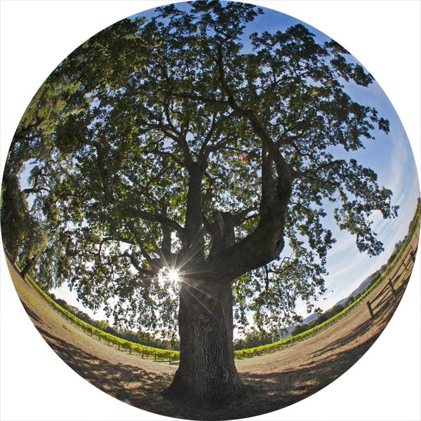
We start off tonight with this beautiful image of a California Valley Oak from Napa Valley, also known as the “White Oak” or the “Water Oak” by some native peoples.
For many cultures around the world, trees have long symbolized the interconnectedness among all life on Earth.
As their leaves change with the seasons, they remind us of the regeneration that accompanies the cycles of life.
Rooted in the ground, they also reach to the heavens.
I would like to invite you to take a moment to connect the earthbound story of life to the heavens above…
Through many generations of careful observation, our ancestors survived by synchronizing with natural ecological cycles. By understanding the natural world, humans learned to adapt and eventually thrive in a wide range of environments.
Image courtesy of Tim Horn, 2011. Trefethen Family Vineyard, Napa, CA.
Careful observation of the night sky and engagement with the land allowed native peoples to survive for millennia
The night sky provided an important tool for humans to make sense of the world around them. In particular, to tell time.
We think of time in terms of calendar days and electronic read-outs on our smart phones, but our ancestors used the sky to tell time. The cycles of the sun, moon, and stars describe the rhythms of the world in which we live, and cultures around the world observed these patterns and made use of them for planting, harvesting, and understanding their relationship to the world around them.
Our modern view has changed… We can now embrace a new, global perspective.
Humans and trees are both members of ecosystems—on a planet that itself exists in a cosmological ecosystem of sorts.
More than any other celestial object, the Sun influences life on Earth, providing the energy that drives our climate and our living systems.
Earth’s yearly orbit around the Sun drives familiar changes: the cycle of birth, death, and renewal mirrored in the changing colors of our deciduous trees.
In addition to the cycles and connections observed by Native communities for millenia, modern science and technology allow us to extend our perceptions and understand the conditions for life far beyond Earth.
More than fifty years ago, we began launching satellites to study our home planet and its surroundings, enabling us to expand our scientific understanding of Earth and its cosmic neighborhood.
Shortly after the launch of our first satellites, we discovered that Earth creates a magnetic field that protects life from the very object that powers life on Earth.
Along with light and heat, the Sun emits a steady stream of energized particles we call the solar wind. Earth’s magnetosphere acts like a force field that shields us from otherwise damaging radiation.

But most importantly, the Sun’s light warms our planet and provides the raw energy for life. We’re just the right distance from the Sun, so Earth’s surface can sustain liquid water year round.
We reside in what’s called the “Habitable zone” or “Goldilocks Zone”—the temperature is not too hot, and not too cold—just right so water doesn’t permanently evaporate or freeze on a planet the size of Earth.

We can now see the orbits of other planets; indeed, we tend to think of our Solar System purely in terms of the eight planets… But many other objects—comets, asteroids, and numerous small bodies—exist in the space around and between the planets.
Indeed, much of the water on Earth arrived here when comets and asteroids collided with our planet.

And our Solar System isn’t alone. In the past 15 years, we’ve discovered hundreds of planets outside of our own solar system.
Each of these cross-hairs is centered on a star that has at least one planet orbiting it.
However, of the hundreds of planets discovered, we have only confirmed two, so far, that reside in their parent stars’ habitable zone. But both those planets lie trillions of miles away from us, so we won’t be traveling there any time soon.
Aside from the planets we have discovered, the stars themselves speak to the origins of life—from the iron of Earth’s core to the oxygen in our lungs, from the calcium in our bones to the carbon in the leaves of trees, the rich suite of elements were all originally created in hearts of stars. We are literally made of stardust!
The remains of exploded stars reside throughout our galaxy—as do regions where new stars are born—material forged in the hearts of stars spreads through space to become the next generation of stellar furnaces.
The cycles of nucleosynthesis and stellar birth take billions of years. And Earthlike planets are few and far between…
We must recognize the value of our place in the Universe and ensure the resilience and continued health of our home planet.
The conditions on Earth are regulated by cosmic forces interacting with the oceans, atmosphere, clouds, ice, and land over the course of billions of years.
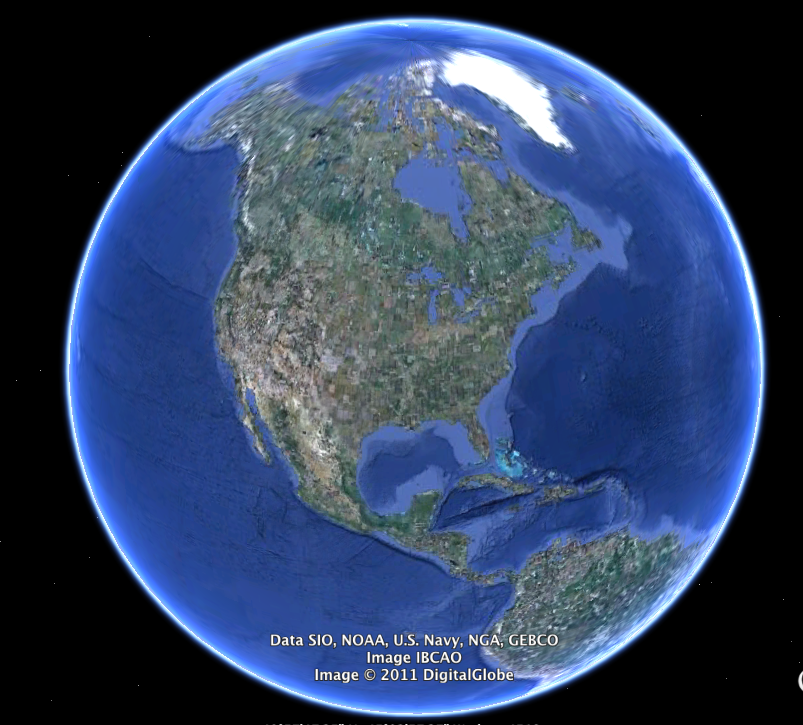
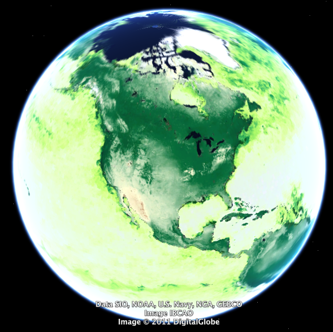
While the conditions for life on Earth have been shaped by cosmic forces, the presence of life over billions of years has in turn shaped Earth’s environment.
Together with Tim Horn, who is piloting live, we will now take you on a journey around our planet and into our own backyard, into the past and into the future, to explore how human communities and the diversity of life depend on one another.
Many native cultures and some scientists envision the Earth as being alive as a global interconnected living system
Satellites, our eyes in the sky, now enable us to see her “breathing.”
From space, we can see our planet create living plant matter that is the foundation of all Life.
Here in WINTER, most of the view of our home continent is pale, showing where environmental conditions cannot support the creation of new life. Where this image is green, plants are transforming sunlight and carbon dioxide into food that is the basis for all animal life on Earth. This is called primary productivity.
In SUMMER, the northern hemisphere turns vibrant green. We are watching as the plants on land and in the oceans, turn sunlight into life. We can literally see here primary productivity. Each image is a composite during one week across each solstice, DECEMBER and JUNE. (take time - look at dome)
We can clearly see vast forests cycling with the seasons, reminding us of the intimate connection all life has to the yearly cycle around the sun.
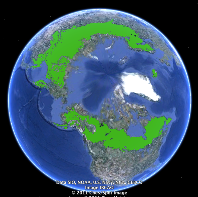
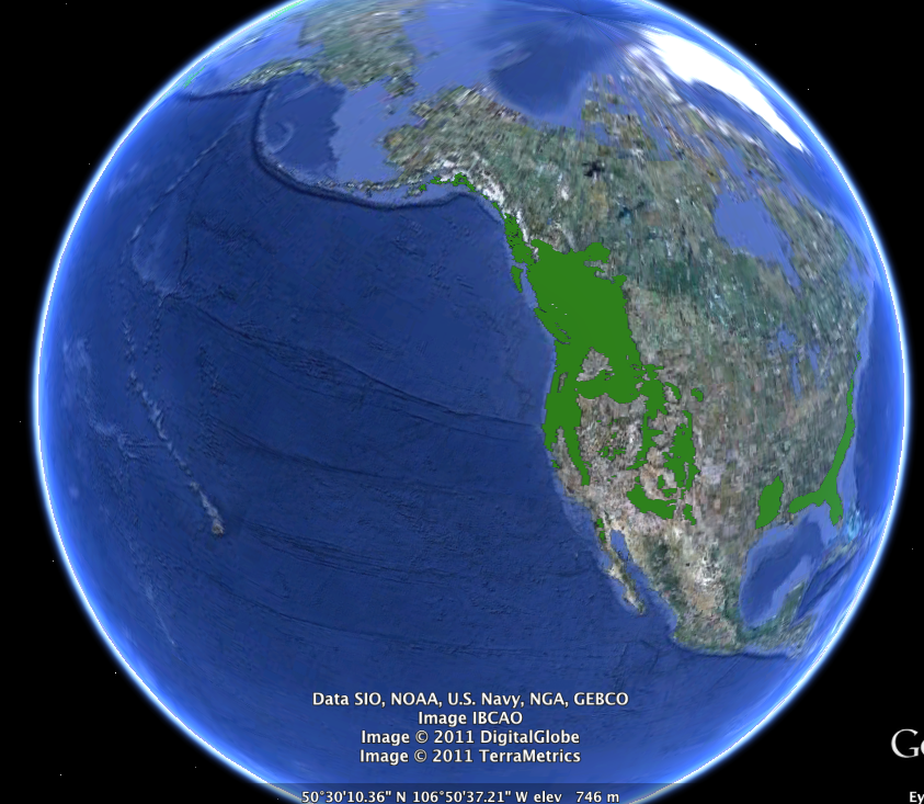
Circling the high north like a green wreath around the arctic, the boreal forests are the largest terrestrial biome on Earth.
Boreal forests, or taiga, are dominated by cold-tolerant evergreen conifers - trees like pine, fir, and spruce. The growing season lasts barely four months between long, cold, dry winters
Because of the low temperatures, decomposition in boreal forests is slow. These frozen grounds and slow growing trees and have locked massive amounts of carbon into this system.
Leaving these delicate forests intact is essential to regulating our global climate
Moving south, we see the temperate forests covering much of western North America, also dominated by the evergreen, needle-leafed conifers.
Along a three thousand mile thin strip of land, from southern Alaska to the Sierra Nevada, a combination of temperature, rainfall, and topography creates conditions for dense, productive growth of conifers, unequalled anywhere on earth.
Perhaps the ultimate expression of this forest type are the great coast Redwoods and inland giant sequoias, the tallest living organisms on our planet.
The Rocky Mountain forest is drier, and more sparsely covered with trees. In the higher altitudes, closer to tree line, bristlecone pines grow, which are now known to be the oldest of all living things on Earth.
Over centuries, humans have interacted with these forest by using fire to cultivate immense stands of fast growing and valuable lodgepole pine.
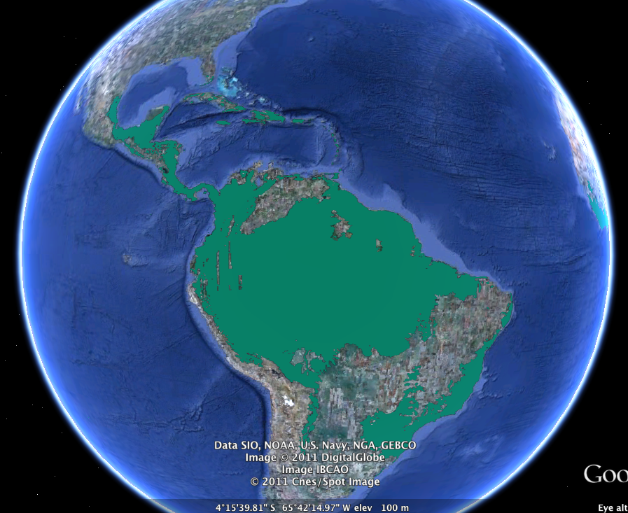
Like the boreal in the North, the equatorial regions of Earth’s continents are wrapped with vast tropical forests. Here, the conditions for life are ideal – stable, warm temperatures, and abundant moisture. Year around, these forests are actively soaking up carbon from the atmosphere, converting the sun’s energy into abundant plant life, and producing enough oxygen to earn the title of “the lungs of the planet”.
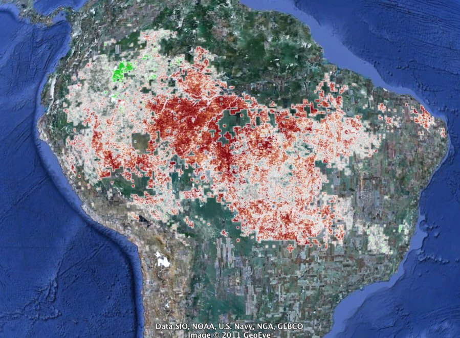
But these processes depend on climatic conditions. satellites , measuring Earth from space, again have shown us how the climate system and this Amazon forest system are closely entwined.
Last year, Earth’s largest remaining tropical forest experienced a massive drought. Where the green forest is colored red, you are seeing the harmful impacts of drought stress. Between July and September last year, satellites showed us the reduction in photosynthesis caused by lack of moisture. New life could not be created where normally it is abundant and productive. The darker the red color, the greater the negative impact.
The availability of moisture determines the amount of carbon the Amazon forest can remove from the atmosphere. When it dries out, it burns. Instead of being a sink, a place carbon can be soaked up and stored, the forest becomes a source of carbon.
In 2005, a similar widespread and devastating drought gripped the Amazon basin. Two severe droughts within one decade. It’s a clear connection between climate and life.
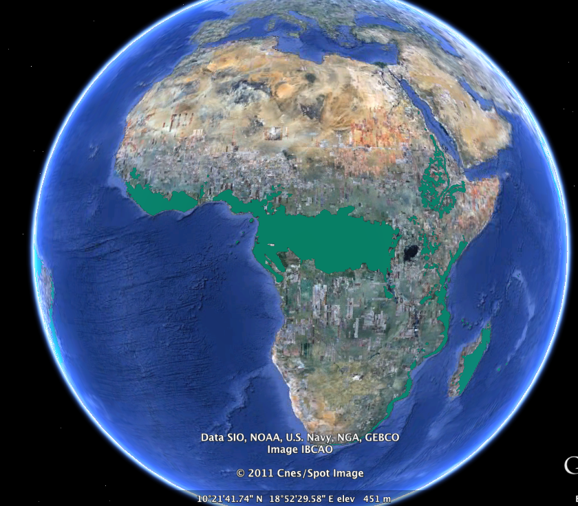
By now I hope you are beginning to understand just how essential trees are as living components of our planetary ecosystem. They absorb CO2 , and produce oxygen, they produce food, fuel wood , construction materials, they filter water, prevent erosion, they provide habitat for animals
With all they provide, its clear how the health of forests directly affects the health of the communities that live within and around them.
Trees are RENEWABLE. We have cleared them over large parts of the planet. But it is also in our power to bring them back
Many African communities are actively involved in tree planting efforts to regreen their landscapes and restore the many vital roles trees fulfill.
The Green Belt Movement, founded in 1977 by Wangari Maathai, has planted 45 million trees in Kenya.
Another effort that is working in Africa and around the globe, the Green World Campaign (GWC) is turning degraded lands green again, while raising the living standards of the rural poor and combating climate change. The founder of the GWC is with us tonight, and we’ll hear from him later.
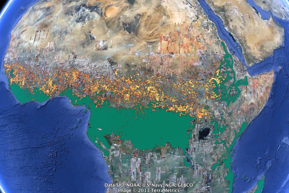
Regreening is not only about planting trees.
All around the world, people use fire to clear land.
By setting fires intentionally, human cultures have been modifying natural landscapes for millennia.
Managed fires improve soil fertility and open up the land for planting specific crops.
But as this composite image of 8 days of fire from February of last year shows, an astonishing amount of land on Earth is burning at any time.
This process of deforestation is responsible for about 20% of all greenhouse gas emissions.
So it is humans and how we manage forests that largely determine whether forests are absorbing, or emitting, the greenhouse gasses responsible for regulating Earth’s climate.
Now we will return to our home here in California, to talk about a species of tree that humans have actively been managing for millennia.
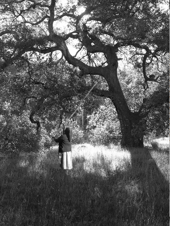
Oaks belong to the genus Quercus. There are almost 500 species of oaks worldwide, many of which have great ecological and economic importance. They have been a major source of timber for centuries. We also derive fuelwood, charcoal, medicinal products, dyes, and cork from oak trees.
Indigenous peoples around the world value not only oaks but also the communities that oaks forests sustain: grazing animals to hunt, fungi and lichen used as medicines, understory grasses and tubers that provide food, as exemplified here by a native woman, knocking acorns from the high limbs of an oak tree.
Oak by Myrna Cambianica, 2009. Fillmore Gazette, http://www.fillmoregazette.com/arts-entertainment?page=37
Woman knocking oak courtesy M. Kat Anderson
WvN03_IIID1_001_oak%20knocking_v2.tif (opens in a new tab)
http://www.fillmoregazette.com/arts-entertainment?page=37 (opens in a new tab)
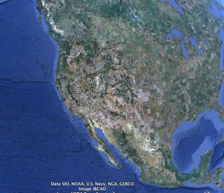
One particular tree species was essential to the way of life of California’s Tribes.
Of the 19 species of oaks native to California, Valley Oaks, are the largest and longest lived of the oak species in North America. Quercus lobata, as they are known scientifically, can survive to 300, even 500 years.
They have been vital to the health and well being of the people living in this region for thousands of years.
Museums of natural history play an important role in our understanding of the biology and ecology of species and landscapes.
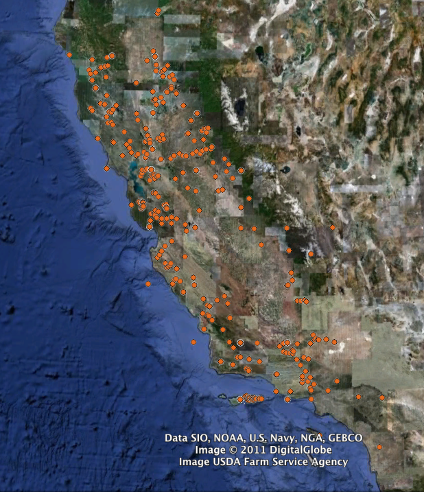
To understand where valley oaks are naturally distributed, we have here mapped the locations of specimens that have been collected by botanists studying the flora of California over more than a hundred years. Each of these orange dots represents an actual specimen in one of California’s herbaria, and collectively they show us where valley oaks live.
Quercus lobata data provided by the participants of the Consortium of California Herbaria. http://ucjeps.berkeley.edu/consortium/.
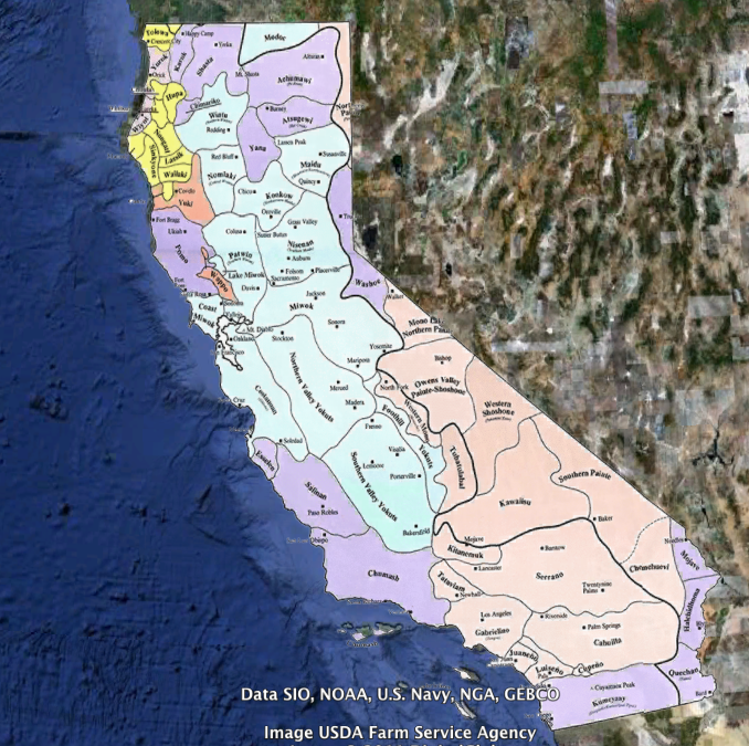
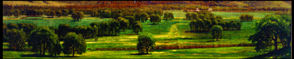
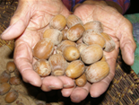
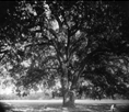
The diversity of VO landscapes were mirrored by the cultural linguistic and diversity of people living here.
Before European contact, there was a diverse array of socio-political units that anthropologists have categorized into 60 distinct language groups.
Many of those languages are still being spoken today, and their knowledge of traditional land management practices is actively being revived.
For such rich cultural and biological diversity to evolve requires a tremendous amount of time, time to learn to tend the wild. The landscapes colonists encountered were the product of thousands years of interaction between this cultural diversity and the surrounding biological diversity.
The open valley oak savannas were intentionally managed by native communities.
They used fire to imitate natural cycles of disturbance. They shaped plant communities through pruning and transplanting. These practices promoted the growth of edible grasses, improved soil fertility, and kept the valley open for hunting antelope, elk and deer.
Native American families actively “tended the wild,” evolving cultural practices adapted to their surrounding landscapes.
There’s a misperception that native peoples didn’t own things. In fact, families were responsible for specific groves of trees. They would maintain the health and productivity of groves from generation to generation.
This early form of agroforestry practiced by tribes affected not only the trees. Flourishing in the light provided by pruning tree limbs, were grasses, wildflowers, fungi, and lichens. Dozens of “crops” associated with oaks were harvested, each in its season.
Native cultures were simultaneously predator and protector, consumer and benefactor. The Valley Oaks received reverence and prayer, and the wisdom to properly care for their needs, so that they may care for ours.
Kroeber, A.L. 1925. Handbook of the Indians of California. Bureau of American Ethnology Bulletin 78.
WvN03_IVA4_012_LanguageMap_CA_crop.kmz (opens in a new tab)
Williams, V. M. (n.d.). Mount St. Helena from Knight's Valley: 26 x 41 21/22 in. The Oakland Museum of California, Kahn Collection
WvN03_IVA4_002_Williams_nodateavail_KnightsValley_A65.63.tif (opens in a new tab)
Courtesy M. Kat Anderson
Hooker Oak, n.d. courtesy Meriam Library Special Collections Department, California State University, Chico.
Catalog #sc50939.
Image of firemaker Courtesy of M. Kat Anderson
WvN03_IVA4_003_to increase acorn production.tif (opens in a new tab)
Reconstructing the cultural and ecological past.
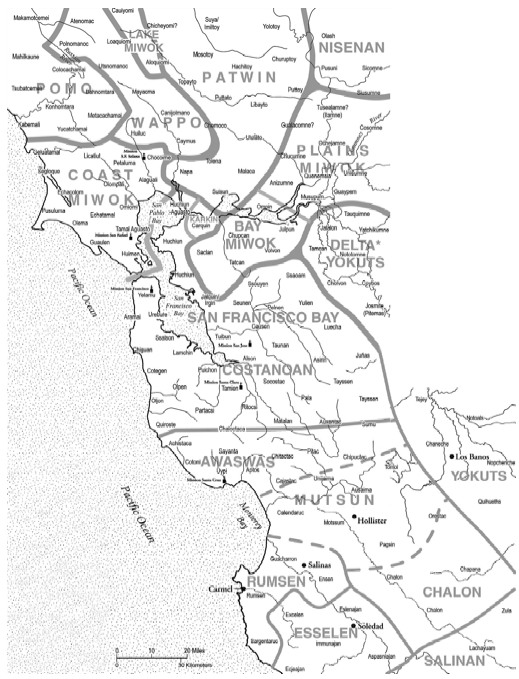
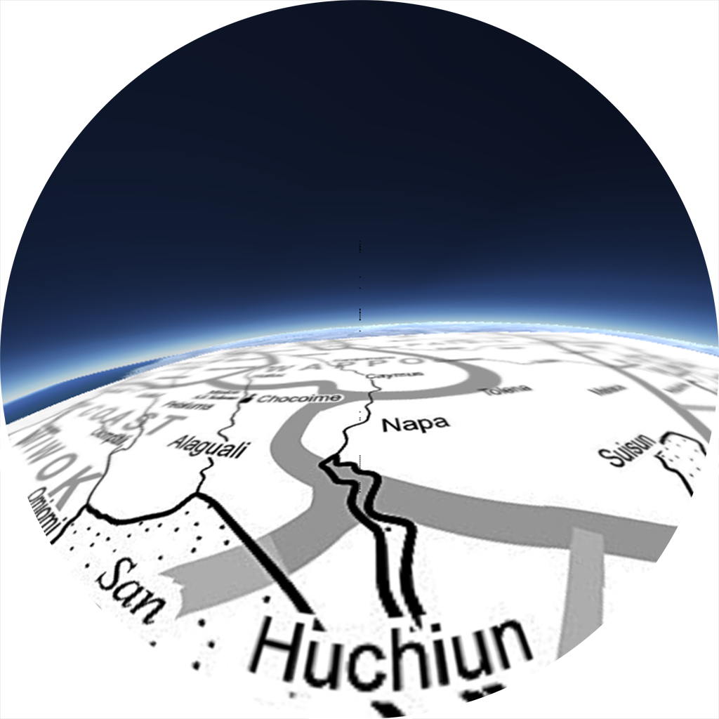
As we zoom in closer to the Bay itself, we begin to see that "anthropological linguistic groupings" don't quite capture the diversity of languages, cultures, and communities once found in the Indigenous Bay. This map represents the actual distribution of the region's tribal communities, as well as the names they had for themselves.
What exactly did their valley oak landscapes look like, how have they changed, and most importantly -- what might we learn from a better understanding of their past? Here we turn to Historical Ecology, synthesizing a diversity of early records to understand the transformations of the past two centuries.
From museums, photographs, sketches, maps, and histories, we know Valley Oaks once dominated much of the California landscape, particularly the fertile, hospitable valleys where many people live today: Thousand Oaks, Oakland, Paso Robles, Oakville,
To explore one of those landscapes, we travel to the Napa Valley, and travel back in time.
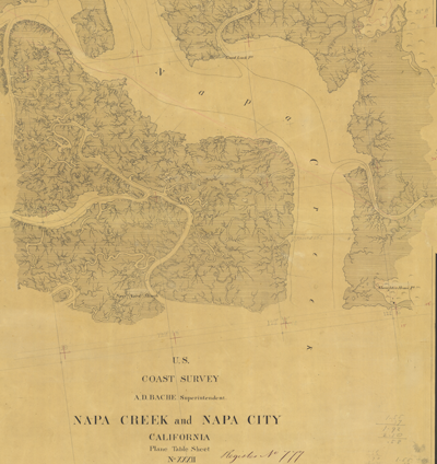
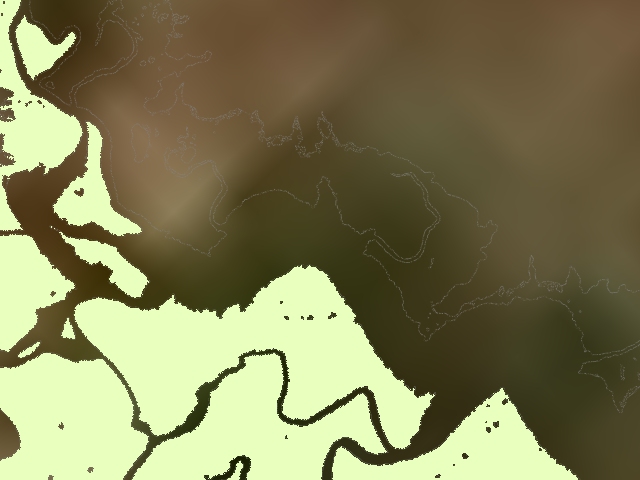
This is one of the earliest, professionally surveyed maps of the Napa area. Starting shortly after statehood, the US Coast Survey [which would later become NOAA] began mapping the navigable waterways of California's coast. The precision with which these maps were made allow us to use them as a baseline, to document subsequent changes in our coastal waterways, marshes, and other near-shore habitats.
With the help of local colleagues, the SFEI has reconstructed the actual native landscape of the early 1800s, based on thousands of historical data documents.
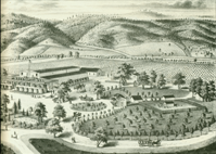
From these historic accounts, we know that European settlements were designed to take advantage of the trees. Their broad canopies sheltered growing towns during the long, hot summer. Even the town of Napa itself grew around a grove of Valley oak trees.
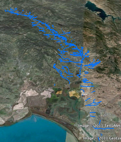
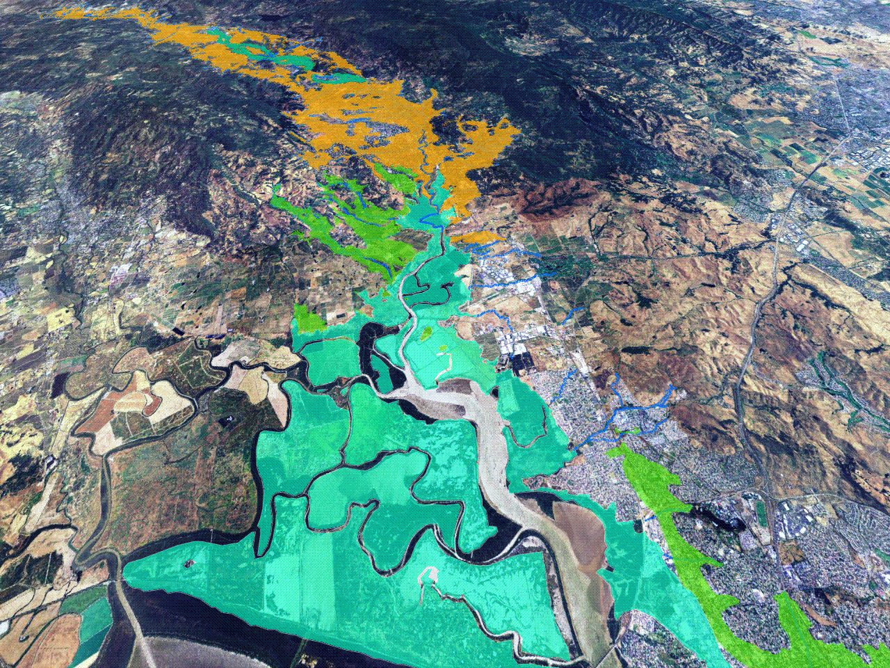
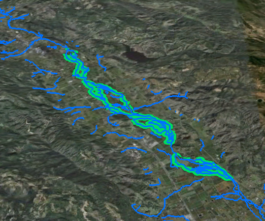
The Napa Valley was a rich and diverse landscape, and its backbone was the Napa river. A complex network of streams fed ample groundwater and built the valley’s famous fertile soils.
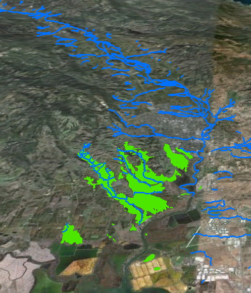
Tidal marshlands were fed by streams draining the surrounding hillsides. Here, we have colored the area that once represented the extent of original marsh. These marshlands dominated to the south, where the valley widened to San Francisco Bay. At the transition between land and water, tidal marshlands are among the most productive ecosystems on Earth.
They provide habitat for migrating shorebirds, rare plants, and juvenile fish, including sturgeon and salmon.
(...)
Grasslands extended beyond the tidal marshes. Native grasses had deep roots which stabilized the soils, recycled nutrients, and tolerated the hot, dry conditions of summer.
The most prevalent habitat was Valley oak savanna, here shown in orange. covering about 36,000 acres in Napa Valley alone-. SFEI’s historical reconstruction estimates that oak savannas covered about 60% of the valley above the reach of the tides.
A diverse mix of trees - Valley oaks, black oaks, coast live oaks, and even some ponderosa pines - were scattered across the valley, with wildflowers and grasses carpeting the ground beneath them.
The pattern of oaks was almost paradoxical – the trees managed to at once dominate the landscape, while taking up relatively little space. Early European settlers described the exquisite symmetry of Nature’s art. This pattern also made the land easily prepared for cultivation.
Broad riparian forests lined the channels of the Napa river, providing flood control and wildlife habitat
The architecture of this landscape influenced the history of development of the Napa Valley we know today.
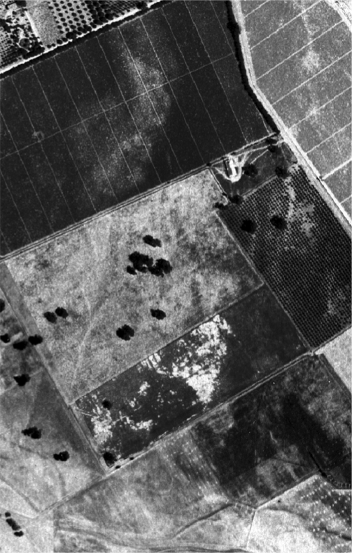
Now we are moving forward in time, to an aerial photograph of Napa Valley from 1942. This very high resolution data is being downloaded now on our computers, so it will take a moment til the past unfolds before our eyes,
Here, we see the valleys were converted to more intensive agriculture, including fruit orchards and vineyards. Before WWII, over 90% of Napa valley’s oaks had been removed.
In this 1942 aerial photograph, you can see a small remnant remained of what once was oak savanna, with the giant, individual trees identifiable from the air, surrounded by vineyards and orchards. The riparian corridor is only a narrow little ribbon, but this tree lined waterway remains.
Map from
Milliken, R., L. H. Shoup, et al. (2009). Ohlone/Costanoan Indians of the San Francisco Peninsula and their neighbors, yesterday and today Technical report prepared by Archaeological and Historical Consultants, Oakland, California for the National Park Service, Golden Gate Recreation Area, Fort Mason, San Francisco, California.
WvN03_VA_014_LanguageMap_BayArea.kmz (opens in a new tab)
Kerr, D. (1858). Napa Creek and Napa City California, Plane Table Sheet XXXII, Register No. T777., United States Coast Survey (USCS).
WvN03_VA_013_NapaTsheet.kmz (opens in a new tab)
Photograph by Turrill and Miller, courtesy of the Society of California Pioneers, catalog no. C014054.
Smith and Elliott, eds. 1878. Illustrations of Napa County, California: With historical sketch. Reprinted,. Fresno, CA: Valley Publishers, 1974
WvN03_VB_005_C027508292_ra.tif (opens in a new tab)
Stream layer courtesy of the San Francisco Estuary Institute, Bay Area Aquatic Resource Inventory (BAARI). 2011
WvN03_VA_015_1800_Channels.kmz (opens in a new tab)
Marsh layer courtesy of the San Francisco Estuary Institute, Bay Area Aquatic Resource Inventory (BAARI). 2011
WvN03_VA_017_1800_TidalMarsh.kmz (opens in a new tab)
Historic Habitats layer courtesy of the San Francisco Estuary Institute, Historical Ecology Program. 2011
WvN03_VA_018_1800_Grasslands.kmz (opens in a new tab)
WvN03_VA_020_1800_ValleyOakSavanna_v2.kmz (opens in a new tab)
WvN03_VA_019_1800_RiparianForest.kmz (opens in a new tab)
Aerial Photos of the Napa Valley, 1942. U.S. Department of Agriculture, Western Division Laboratory.
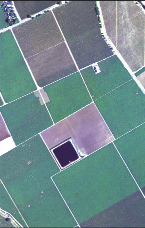
Today, Napa Valley retains less than 1% of its oak savanna.
Moving forward in time, to this aerial photo of the same view, from 2009. Here the individual trees have that dotted fields have given way to agriculture. But even in 2009, the riparian corridor meanders along the waterway, continuing to provide flood control and wildlife habitat. These vestiges of California’s landscapes have been resilient to two centuries of change.
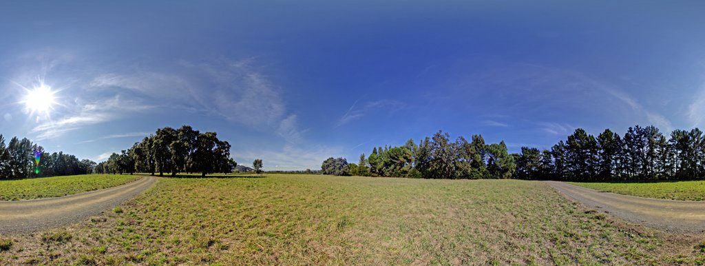
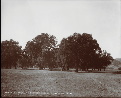
Yet, if you look closely, some trees have persisted. Some residents of California have intentionally preserved the oak’s place in the landscape.
In 1862, “Oak Knoll [was] the residence of Mr. Osborne, one of the largest farmers and most accomplished horticulturists in California.
Reverence for these oaks passed on through generations of landowners and they remain today, relatively intact.
On the Lamareaux family vineyard in Oak Knoll, there are oaks in excess of 300 years old representing one of the last remaining stands of oaks of this kind in the entire valley.
Valley Oaks are still part of our human landscapes. Their many benefits – economic, ecological, and spiritual, suggest they could play a larger role once again -- particularly as we attempt to make our landscapes healthier and more resilient in the face of climate change.
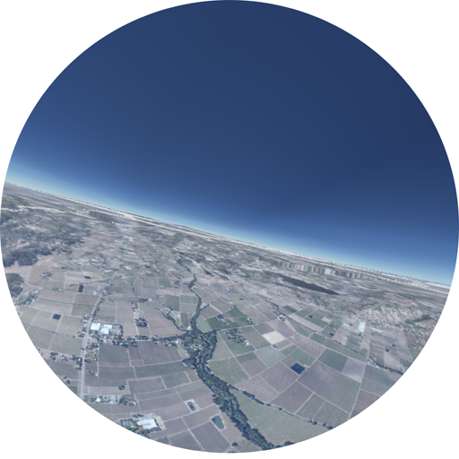
Pano photo courtesy of Tim Horn, 2011.
Photograph by Turrill and Miller, 1906, courtesy of the Society of California Pioneers, catalog no. C027512.
WvN_VC1_Field_01_002.png (opens in a new tab)
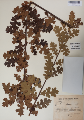
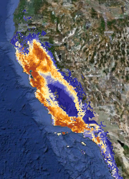
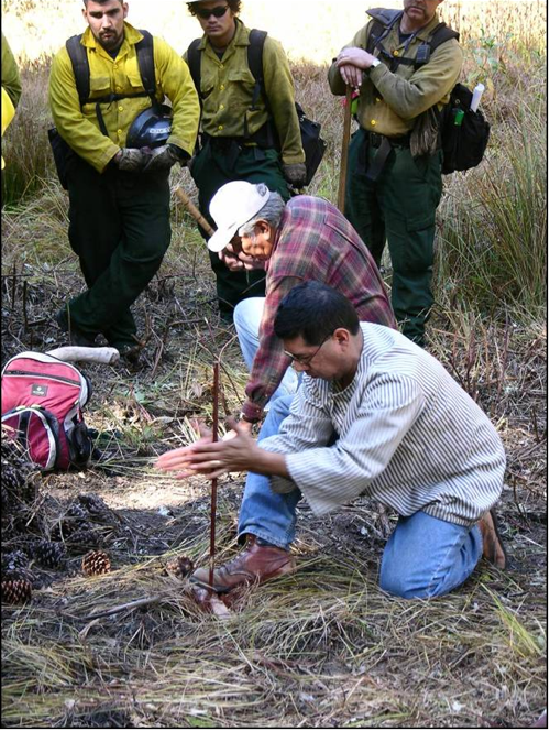
Today, we have an opportunity to find new ways for humans and oaks to coexist: by re-oaking. Bring the oaks back.
But to bring oaks back in a world that is rapidly changing, we need to understand how those changes will influence our re-oaking strategies.
Restoration efforts need to be informed by the best available science. Here again, museum collections play a role.
Museum specimens represent the most verified record of life on Earth, and they help us establish baseline conditions so that we can measure and understand change.
By combining information from museum collections about where valley oaks live, with data from weather stations, we can determine the climatic conditions oaks need to survive.
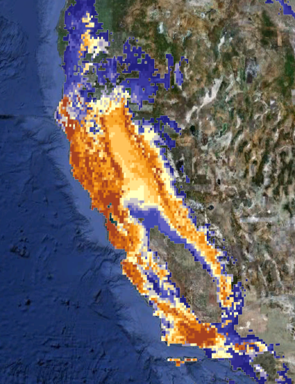
With the historical locations of oaks from museum specimens and observations of monthly temperature and rainfall over the last 100 years, we have created a model that projects where the combination of climatic conditions, or ‘climate envelope’, occurs today. Here, the darker red shows the very most suitable locations of the climate envelope for valley oaks under normal climate conditions.
We can then use information from the best climate models to ask the important question: Where will future climate conditions support the growth of healthy Valley oaks? We are already seeing both plants and animals shift their distributions in response to climate change. Here we use a climate model from the National Center for Atmospheric Research in Colorado. Projected out to 2050, we can see that the suitable climate conditions for Valley oak have shifted.
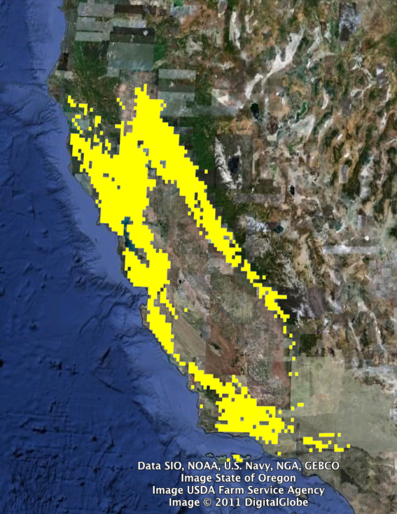
Here, we show the areas of predicted persistance - where valley oaks live today, and where the conditions may still be suitable in 2050.
According to this modeling result, most of the Bay Area is a viable place to concentrate our re-oaking efforts. These ecological forecasts are an important component of a strategy for a greener future.
“Re-Oaking” is a new concept describing an old tradition of planting trees and restoring the ecosystems that the trees rely upon.
The idea is catching on because it is a “win-win-win” solution -by our actions, we can ensure the diversity of life, we can improve our environment, and enhance the well being of human communities. A coordinated approach could help modulate local temperatures and runoff, while storing carbon and establishing corridors of ecological connectivity for the oaks and the native species they support.
Planting oaks back into the landscape also brings people together across generations and reconnects us all to the land. Even small scale efforts, like Robin and his son planting an oak at their local traffic circle, when linked together have significant regional impacts.
Re-oaking brings together native and western worldviews. Today, tribes are working with California state and national parks staff sharing their traditional ecological knowledge, such as restoring fire to the landscape.
1895 Valley Oak specimen from the California Academy of Sciences Botany collection.
WvN03_VB1_009_HerbariumSheet.tif (opens in a new tab)
Quercus lobata data provided by the participants of the Consortium of California Herbaria. http://ucjeps.berkeley.edu/consortium/.
WvN03_IVA3_010ValleyOaksMuseum.kmz (opens in a new tab)
http://ucjeps.berkeley.edu/consortium/ (opens in a new tab)
Valley Oak projected distribution for the year 2020 under “business-as-usual” (A2), greenhouse gas emission scenario. Dr. Healy Hamilton, 2011.
WvN03_VIB1_021_Climate_Current.kmz (opens in a new tab)
Valley Oak projected distribution for the year 2050 under “business-as-usual” (A2), greenhouse gas emission scenario. Dr. Healy Hamilton, 2011.
WvN03_VIB1_022_Climate_2050.kmz (opens in a new tab)
Valley Oak predicted persistence for the year 2050 under “business-as-usual” (A2), greenhouse gas emission scenario. Dr. Healy Hamilton, 2011.
WvN03_VIB1_023_Climate_Persist.kml (opens in a new tab)
WvN03_VIB1_023_Climate_Persist.png (opens in a new tab)
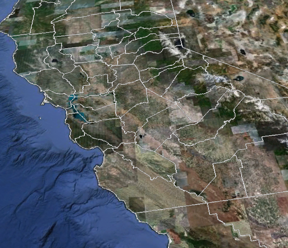
WvN03_VIB1_024_CA_County.kmz (opens in a new tab)
Photo by Robin Grossinger
WvN03_IVB1_010_Grossinger_ClaytonsOaks_IMG_1448.tif (opens in a new tab)
WvN03_IVB1_012_IMG_2996.jpg (opens in a new tab)
Photo Courtesy Brent Johnson, National Park Service, Pinnacles National Monument
WvN03_IVB1_013_JayandPhillip_ignitionYV24_courtesy Brent Johnson.jpg (opens in a new tab)
Here we are, under the canopy of our Napa Valley Oak. We’ve traveled through space, to understand how unique and fragile our planet is. We’ve traveled around earth, seen some of its great forests, and have learned how they support OUR life – with practical goods and services, and a spiritual connection between heaven and earth. We’ve traveled through time, into the past of our local landscapes, to learn that both native communities and today’s built environment were shaped by this very special tree, the valley oak.
Can we now envision our future? Can these elegant, drought tolerant trees be brought back into our communities, rural and urban? Can we integrate native practice and western science to actively create our common future in a more verdant world?
For 4:30 presentation: We have invited you all here to ask that question together, and we can now begin our dialogue with a new and shared perspective.
FOR 6:30 presentation: 2 hours ago we brought 300 regional partners together to ask that question. Elders from 4 tribal communities, land managers, conservationists, scientists, artists and educators came together with a new and shared perspective, to invoke a dialogue about bringing back the valley oak. We invite all of you to be part of that dialogue, part of efforts to re-oak our communities and landscapes.
Image courtesy of Tim Horn, 2011. Trefethen Family Vineyard, Napa, CA.